

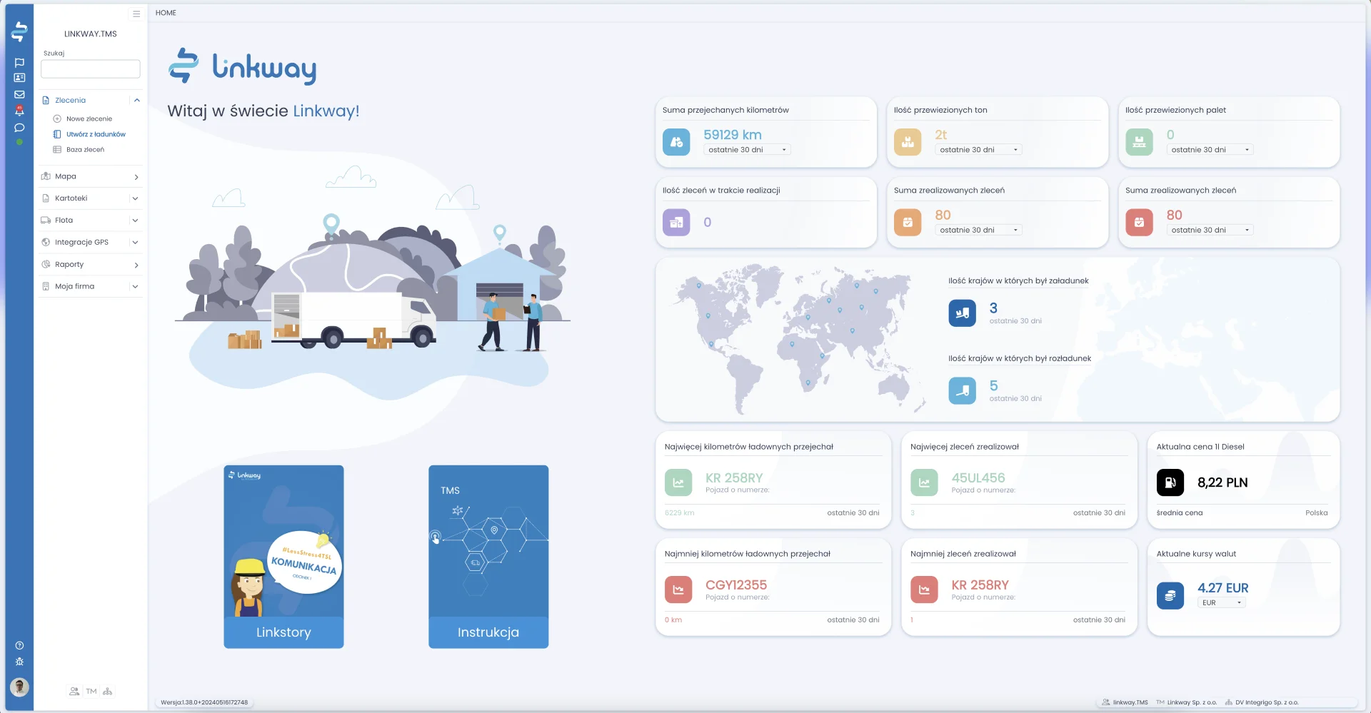
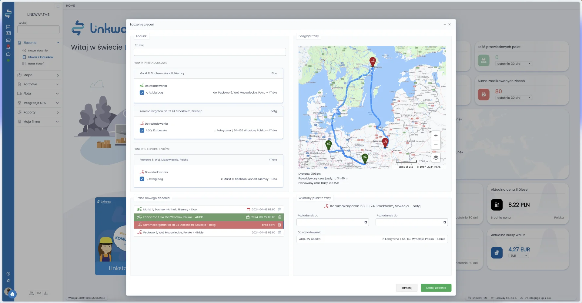
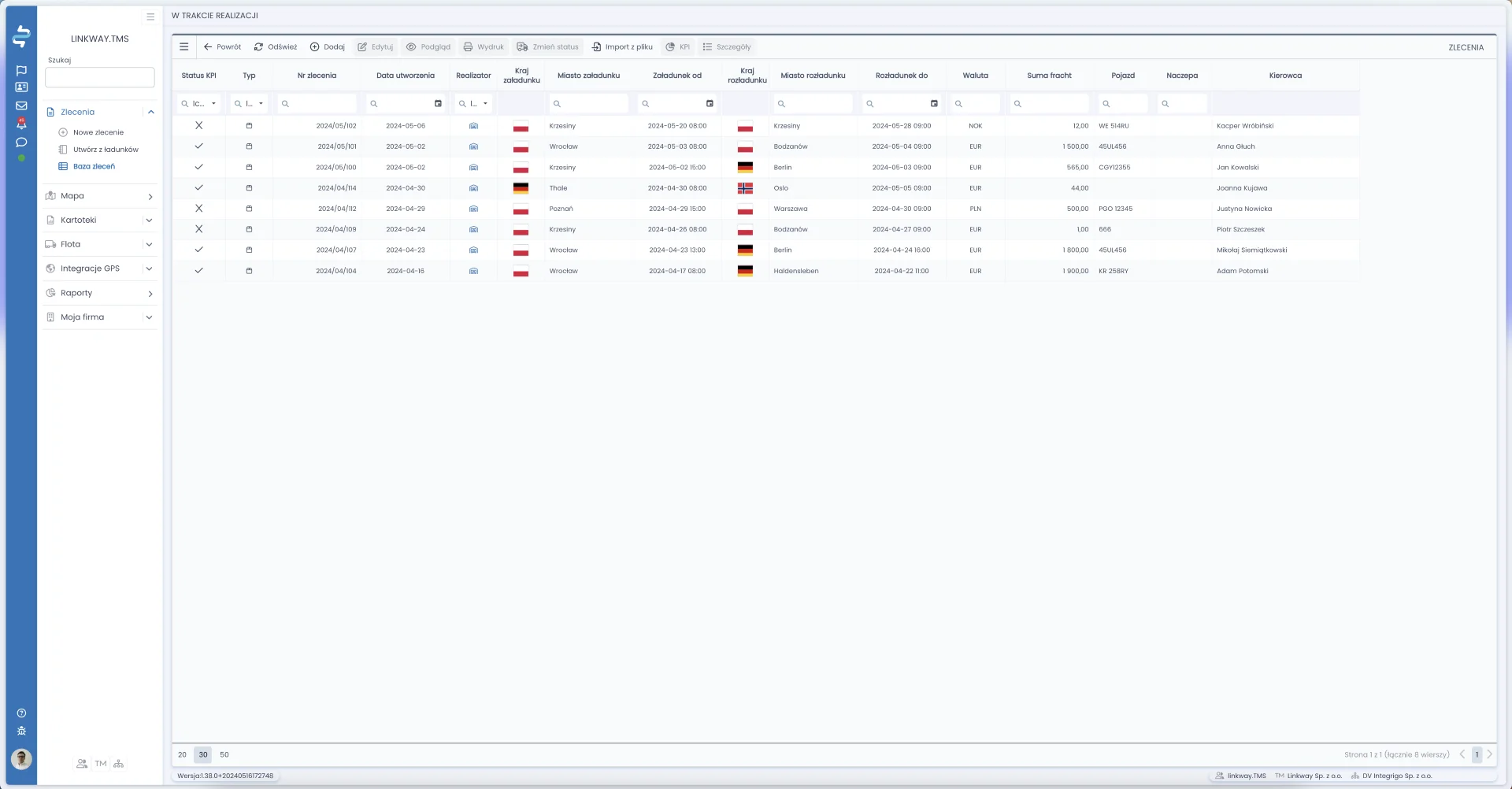
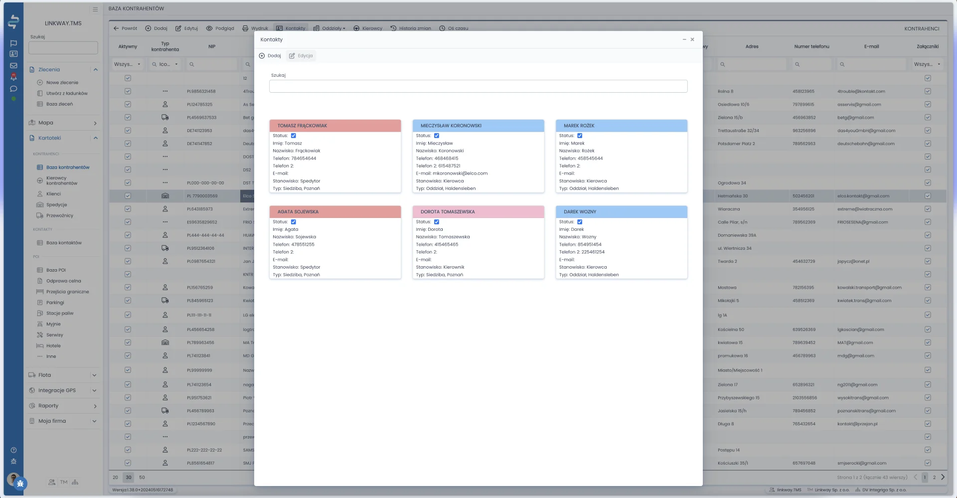
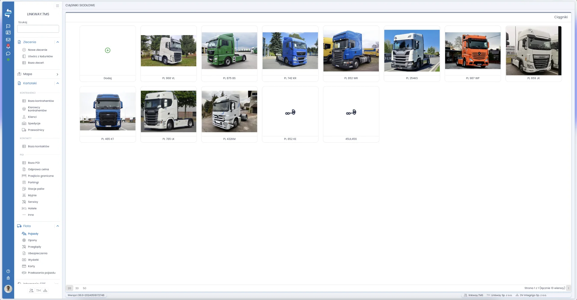


Najlepsze systemy TMS 2025
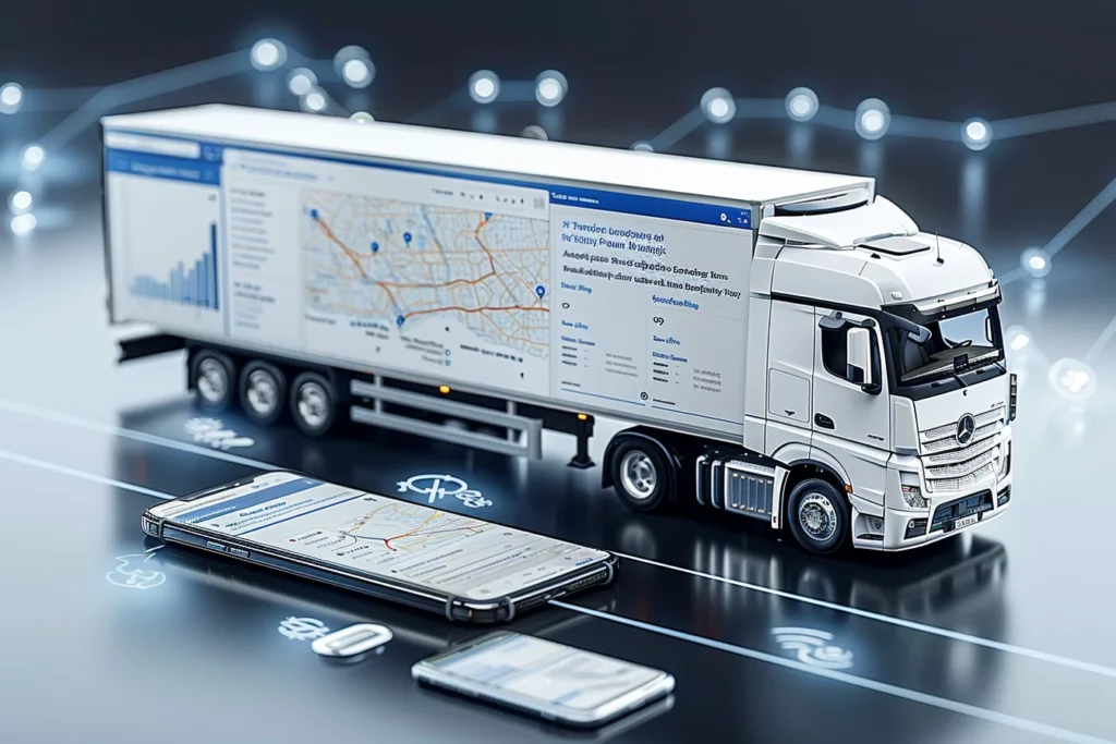
Branża TSL – obejmująca transport, spedycję i logistykę – odgrywa kluczową rolę w polskiej gospodarce, odpowiadając za niemal 6% krajowego PKB. To jeden z najsilniejszych sektorów usługowych, a pod względem liczby zatrudnionych ustępuje jedynie handlowi i edukacji. Właśnie w tym dynamicznym i wymagającym środowisku rozwijamy system linkway.TMS – nowoczesne narzędzie stworzone z myślą o realnych potrzebach firm z sektora TSL.